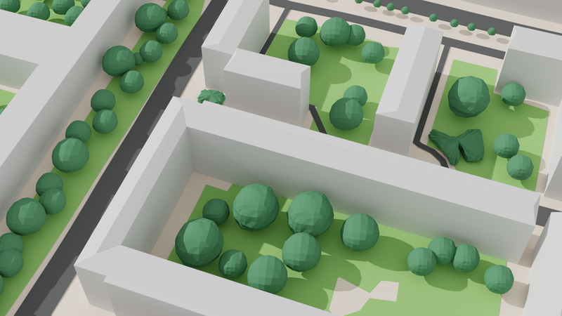
Urban microclimate simulation explained
There are a number of different effects with complex dependencies to consider when looking at urban microclimate. Here, we take a look at a concrete simulation and discuss what’s going on. These effects are what enable us to plan green cities with a high quality of living. Simulations are the foundation that show us in concrete numbers how urban planning and zoning can help us to mitigate urban climate change.
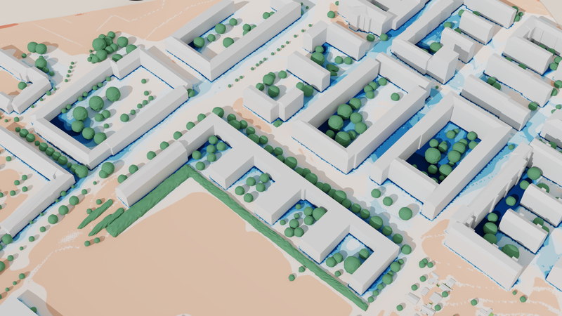
Before we dig deeper, here is a short video that quickly goes over a number of factors that can be seen in our simulations. The video is a straight screencast of a simulation shown in RheoView, our 3D viewer that comes with every microclimate simulation to facilitate team collaboration and make the results more accessible.
Time is fleeting…
The single biggest influence factor for microclimate is the sun, respectively its path across the sky. In our microclimate simulations, we simulate time dependently, meaning we calculate how the wind flows through the area and the sun moves across the sky for an entire day. Usually, when we are looking at urban climate change mitigation, we want to see the effects when it is hottest, which is often around 14:00 local time. The video above, as well as the images below, show the situation at this single point in time even though the simulation itself covers the entire day1.
Of course, the sun is not the only thing about the local microclimate that changes over the day. Wind velocity, humidity and air temperature also change and of course our simulation accounts for that and likewise adjusts these values at the inflow into our simulation domain as simulation time passes. The values themselves are based on historic hourly weather data, usually an average of the last 10 years.

The many functions of trees in urban microclimate
Trees fulfill a number of important functions in urban microclimate. First, they create shade - sun rays generate heat where they hit a surface, and when they do so at a height above pedestrian level, this heat is kept away from where it would negatively impact the perceived temperature. Because of this heat, trees need to evaporate water to stay cool, the same strategy that the human body uses to cool down. This also cools down the air surrounding the trees, which helps to lower the air temperature on hot days.
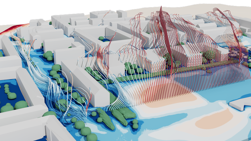
Lastly, trees also direct and reduce wind flow. The flow is slowed down by the leaves, which helps to keep cool air from being blown away immediately. This is one of the reasons why a whole tree canopy is much more effective at cooling than a single tree. Depending on their shape, trees have another benefit on hot summer days: they increase wind flow at pedestrian level, generating a cooling breeze. Air is pushed aside by the crown of the tree, which results in higher wind velocity under the tree, which makes people feel cooler2.

Free, evaporative cooling
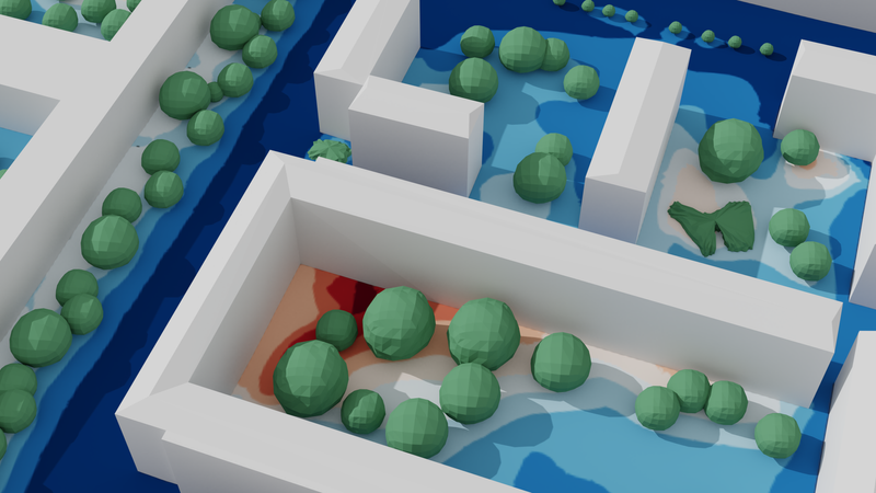
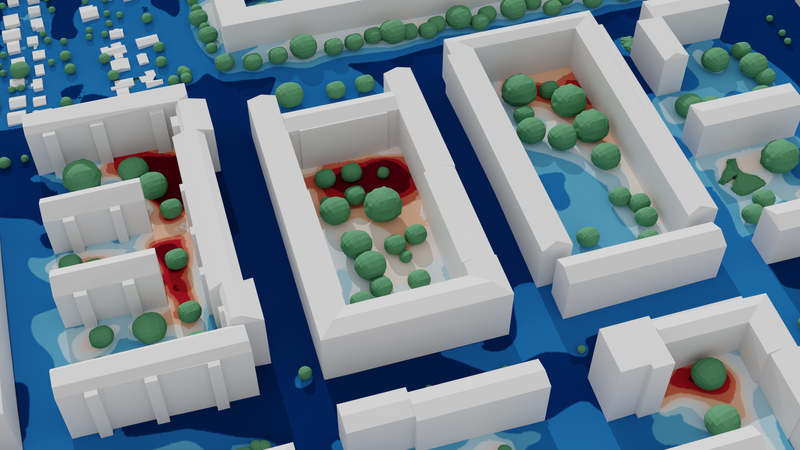
As long as there is moisture in the ground3, all plants evaporate water to cool themselves - and the surrounding air - by evapotranspiration. We are using tried and tested values from scientific literature and agricultural experience to set the factors for evapotranspiration. Saturation of the air also plays a role - the closer the air is to 100% relative moisture, the less a plant will evapotranspirate and the cooling effect becomes smaller, even if there is plenty of water to evaporate.
Note that while the absolute humidity is not directly influenced by air temperatures, the relative humidity is. Colder air can hold less water, so with same amount of water in the air, colder air will feel more humid than hotter air. This can be seen in the simulation: our buildings are relatively cold (like on a hot spring day for example), which results in cool air, especially downwind of the vicinity of buildings, and therefore in higher relative humidity.
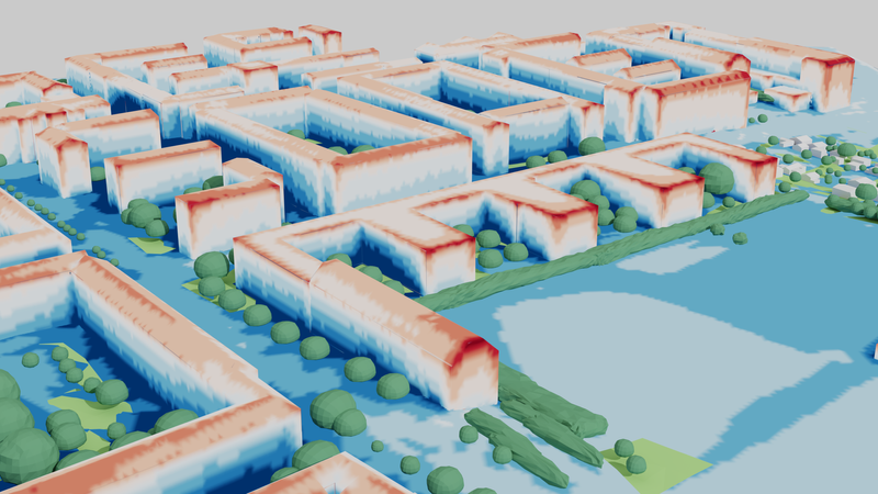
Sun, shadow and surface temperatures
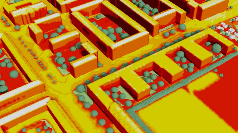
While incoming solar radiation is the main influence factor on surface temperatures, it is far from the only one. Surfaces also have different albedo4, they exchange heat when they are in direct contact (e.g. houses with soil) and the air also transfers heat to surfaces. Naturally, if a surface is evaporating water (grass, foliage), this also influences its temperature.

As we have mentioned earlier, shadows move with the sun in the simulation, and the amount of time a certain point on a building facade is shielded from the sun, for example by trees, will influence its temperature over time. Conversely, there are surfaces that have high exposure to the sun - especially southward-facing, slanted roofs which become much hotter than other surfaces. This is typically the case for penthouse constructions. In these cases, our simulations even indicate where the construction would energetically benefit from additional insulation to prevent excessive heat-up of the interior.
All these effects combine to the picture we see in our simulation, where areas in the shade, out of the wind and with vegetation tend to be the coolest.

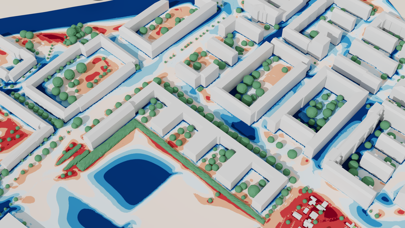
Temperature vs. apparent temperature
The actual local air temperature at pedestrian level is influenced by all the factors above and can easily vary several degrees due to the influence of architectural design and landscaping. Even higher differences can be seen in the apparent temperature, which describes how a certain place feels. This metric captures all the mentioned factors (sun / shadow, air temperature, wind velocity, humidity) and demonstrates how a place will actually feel like under the simulated conditions. Even though this may seem somewhat subjective, it is undeniably a huge factor for quality of living and heat stress mitigation. Just imagine how different it feels when moving from the parking lot on a hot sunny day into the shade of a big tree and a light breeze setting in - this is exactly what apparent temperature expresses in numbers.

The better this can be managed in a city overall, the less people will want to install air conditioning systems, as explained in our article about the influence of air conditioning on urban climate. There are a number of places where extra care should be taken to get this right: open areas near hospitals, playgrounds for small children, retirement homes, waiting ares for public transport and local recreation areas, to name a few.
Apart from the health impact, the design of high quality outdoor environments is also important for economic reasons. Retail complexes, outdoor dining areas, esplanades and similar areas where it is economically desirable that pedestrians / customers encounter conditions that invite to linger, all benefit from thoughtful urban design, landscaping and zoning. Wind especially can also quickly become a hazard, which is why we do offer pedestrian wind comfort / danger analytics. Tall buildings that often cause downdrafts and narrow street canyons can be especially dangerous for children, elderly and infirm persons, but also for cyclists, if bike lanes happen to run through areas with high wind velocity.

Lastly, where urban landscaping and buildings cannot create ideal conditions, the information gained from microclimate simulations is helpful for placemaking and zoning, since it allows for planning the use cases for an area in accordance with microclimatic conditions, giving urban planners the right tools for their work. A place that is a bit too windy to sit and read a newspaper might be ideal for sports, for example. We can tell you where these places are.
If you’d like to involve us in the planning of your project, let us know! To get a better idea of what you’ll get, take a look at our urban microclimate service page!
We are also able to calculate night-time cooling and can do multi-day simulations, e.g. to show slower effects like the heating of entire buildings and to simulate maximum night-time temperatures ↩
Higher wind velocities allow moisture on our skin to evaporate faster, making sweating more effective, as long as the air temperature is below the body temperature. The direct cooling effect also helps, though to a much lesser extent than the evaporation cooling. ↩
It’s a safe assumption that in a well-managed urban environment, plants do have enough water, either from rain or through active watering. ↩
The amount of incoming radiation that is reflected back. The higher this value, the less a body warms up from radiation. Generally speaking, brighter surfaces (snow, white houses) reflect more radiation than dark surfaces. ↩
Published: